Major road closure expands:
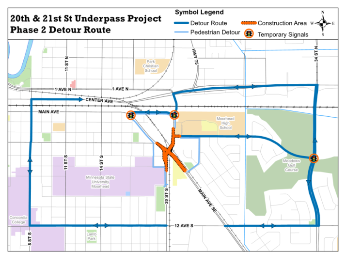
The next major road closure for the SE Main 20/21 St Railroad Underpass Project is the complete closure of the intersection of SE Main and 20 St|21 St (all directions), which begins Monday, October 15 and will be in place for more than a year. With the entire intersection of SE Main and 20 St|21 St closed, traffic should use either 12 Av or Highway 10 as an east/west route and 34 St S or 8 St S as a north/south route.


Other travel impacts as of Oct. 11, 2018:
4 Av closed – vehicles are encouraged to use Highway 10 and 12th Av as detours
22 St (Euclid) is closed
2 Av down to one lane, serving only as an entrance to the high school
Oakway and Birch Ln intersection has a temporary roundabout in place
1 and 12 Av a detour routes will remain active
20 St S Detour route will become active Monday Oct. 15th
Vehicles entering Moorhead High School parking lot should use the entrance on the east side of the school along 4 Av.
Please note that conditions and road closures may change with short notice. For the most up-to-date information, please register to receive direct e-mail updates. You may also check for information at http://cityofmoorhead.com/underpass.
To learn about other public construction projects in the City of Moorhead, visit the Current Projects Map at www.cityofmoorhead.com to read more about upcoming projects including maps, project scope, current status, and traffic impacts.
